3D Site Analysis
GMJ has developed a suite of advanced 3D analysis tools to support the planning and design of development within complex urban environments.
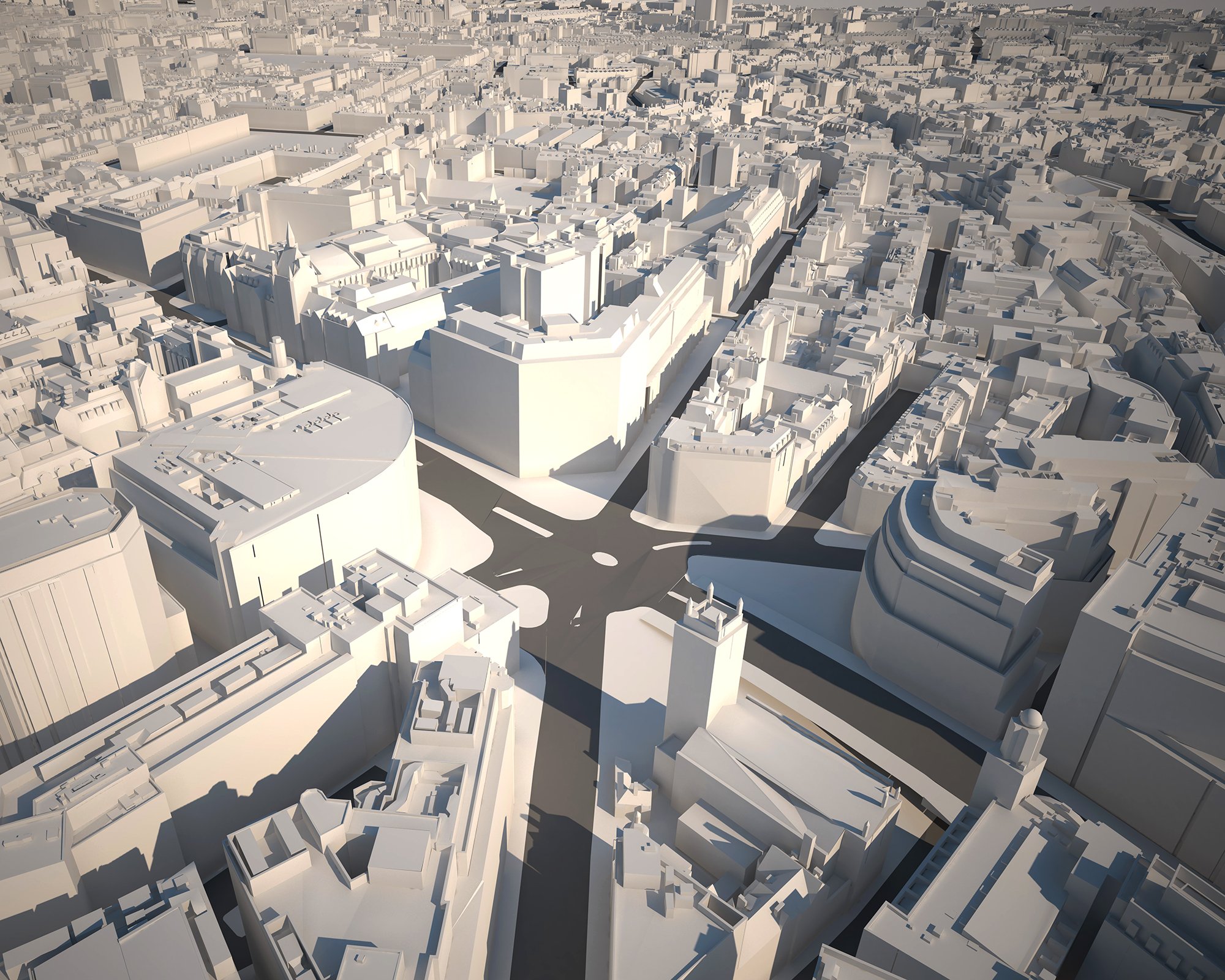
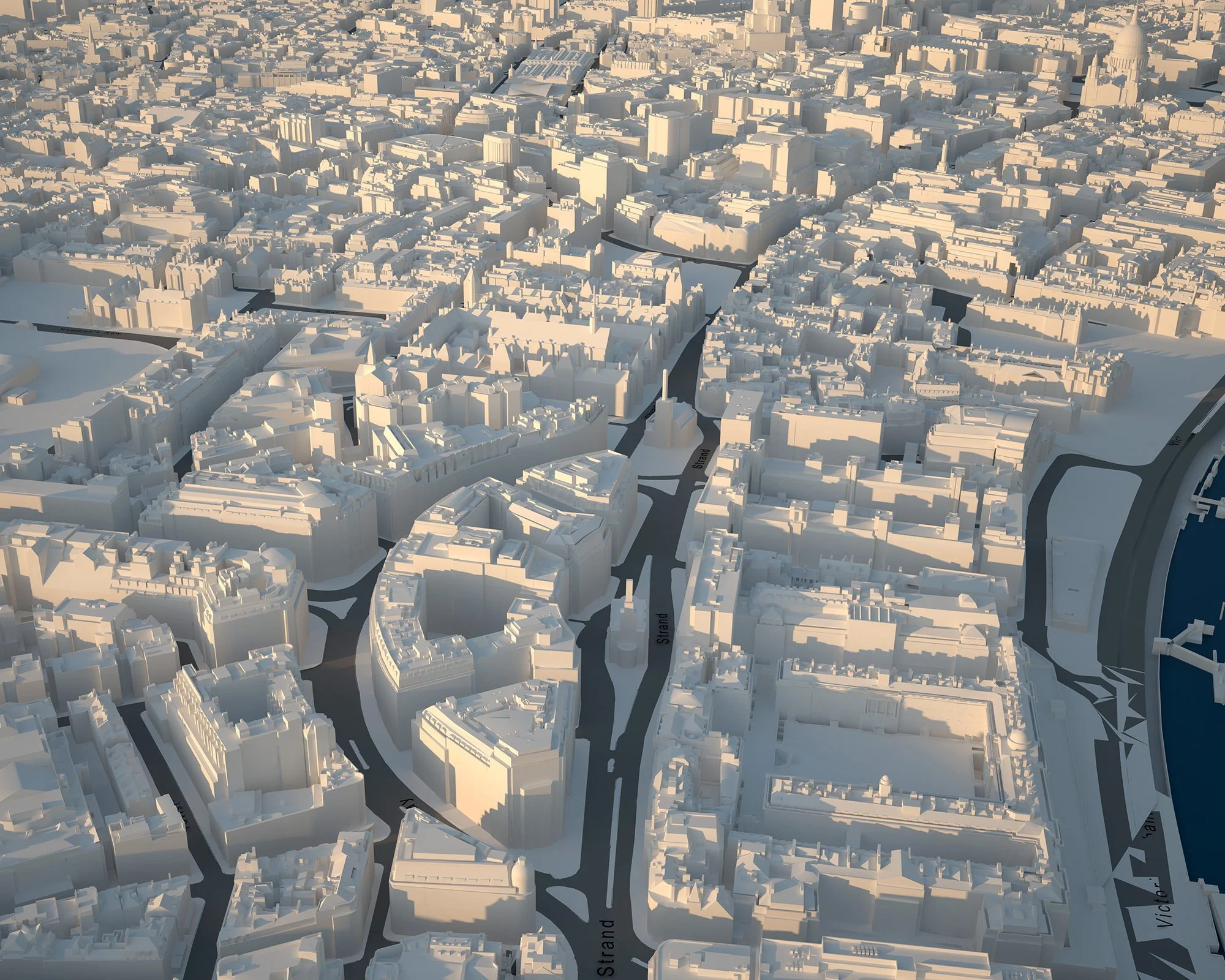
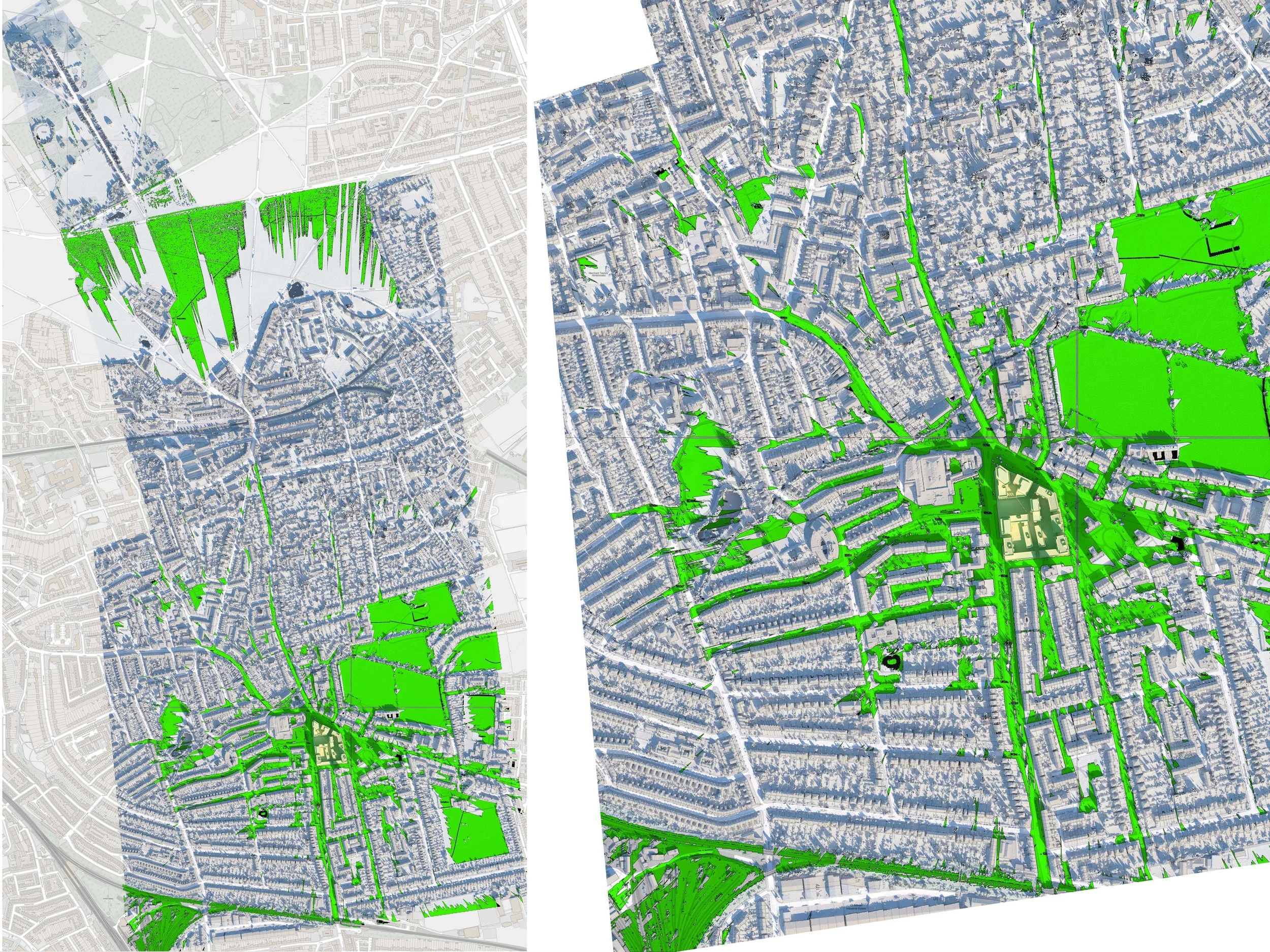
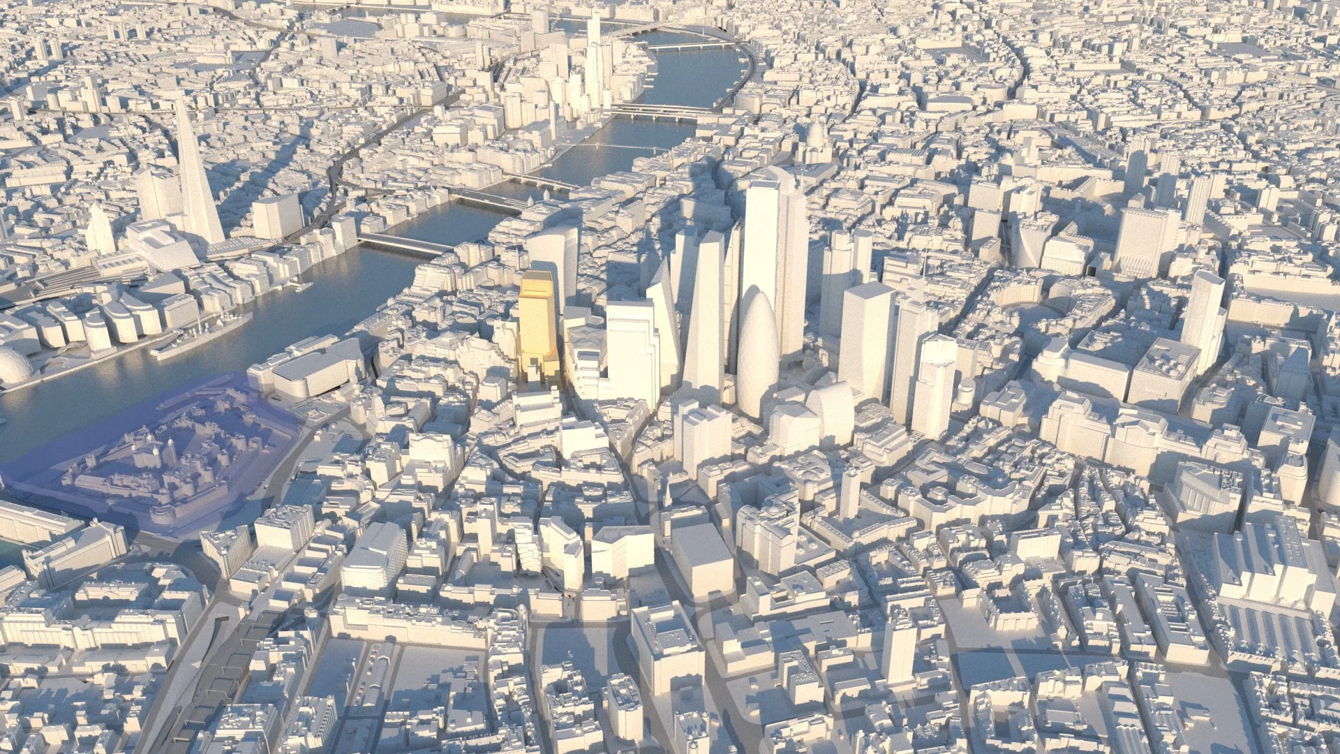
These tools evolved from GMJ CityModel, the first accurate large-scale digital model of a major city. Developed in 2004, it combines survey data and photogrammetry to create a detailed model covering over 40 square kilometres of central London, enabling rapid early-stage site evaluation to identify planning height thresholds, constraints and development potential.
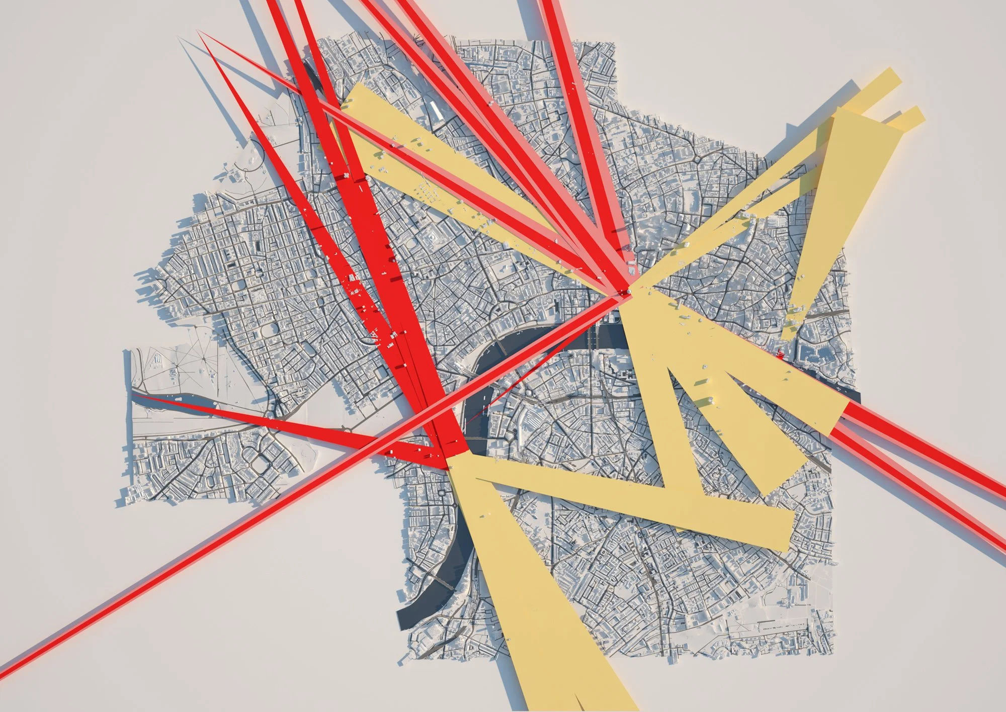
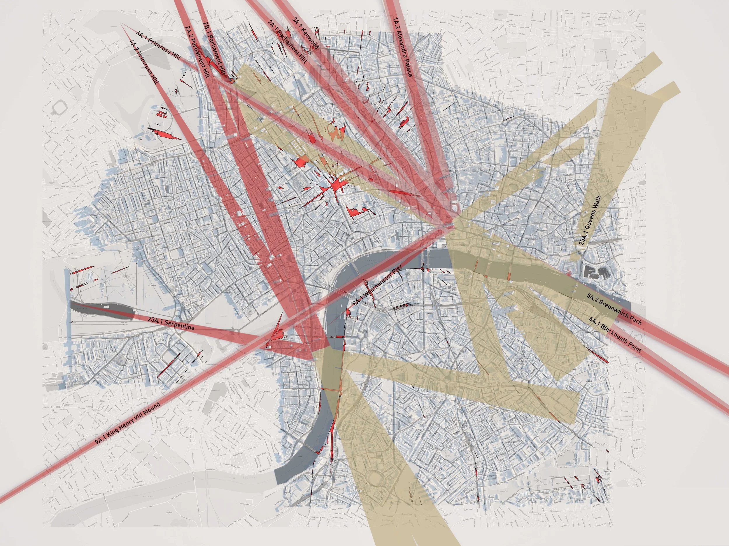
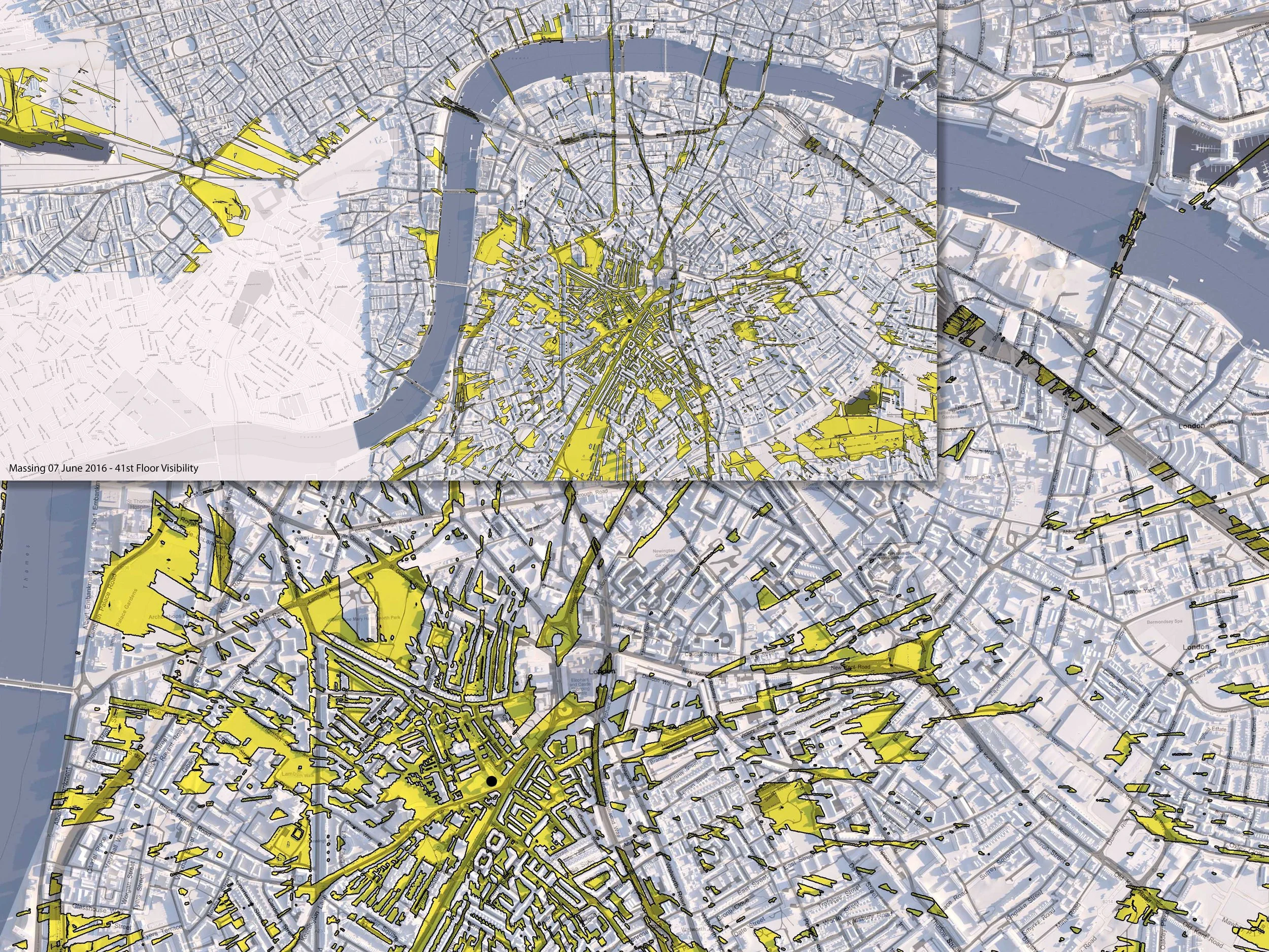
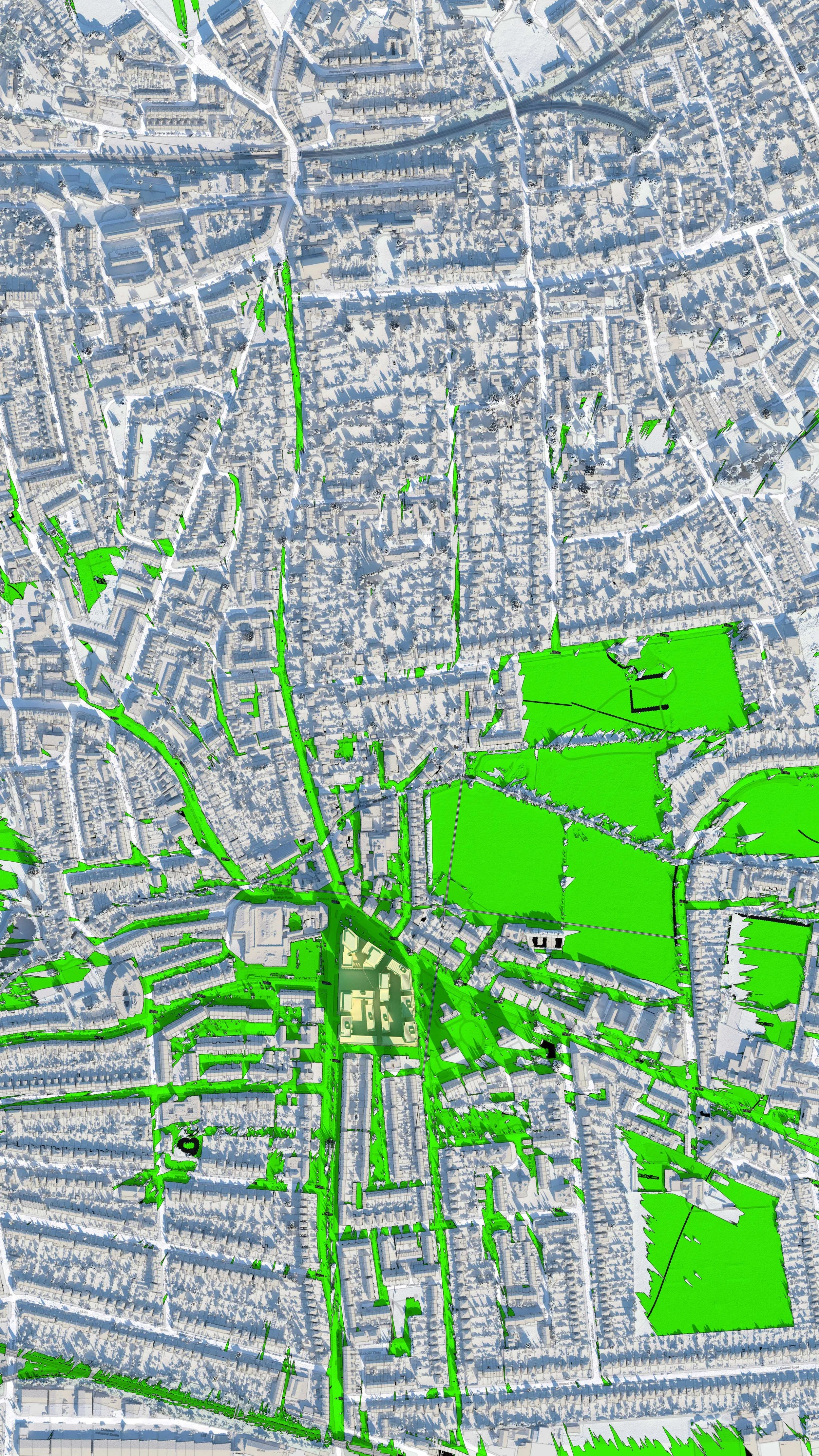
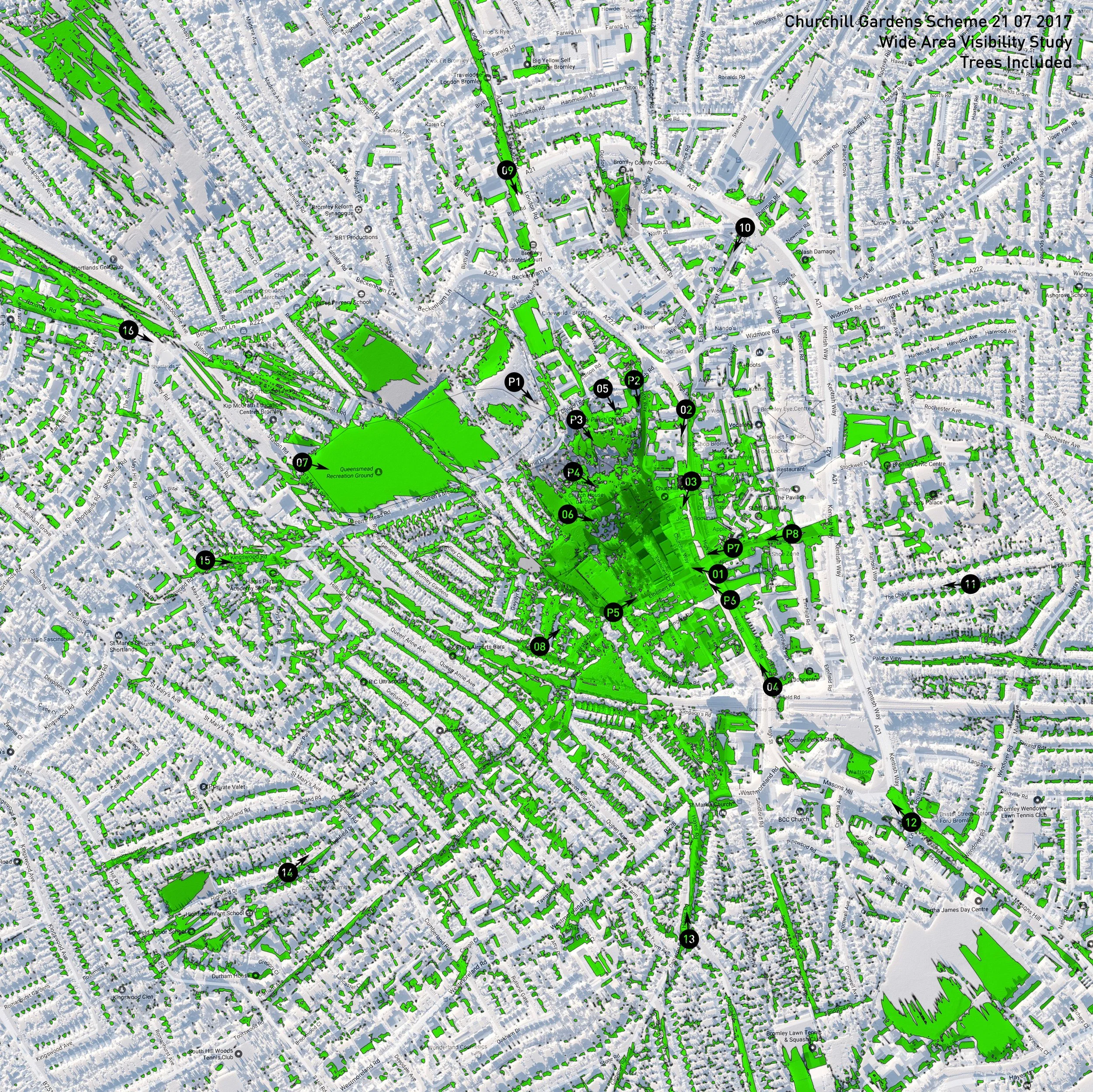
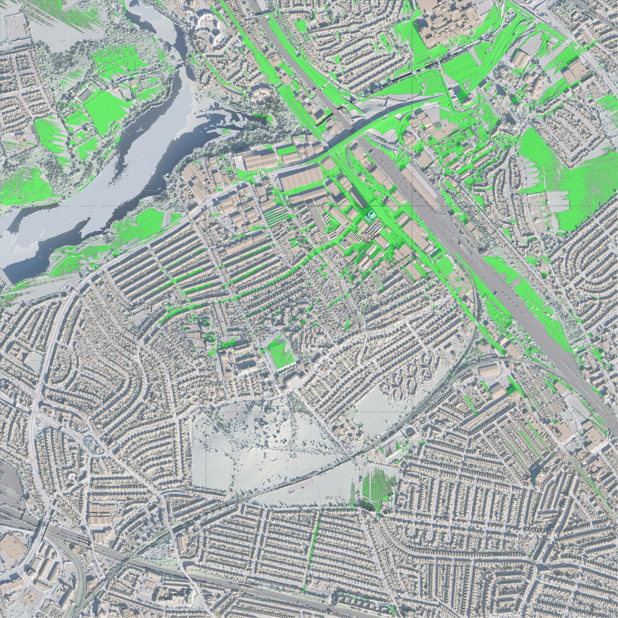
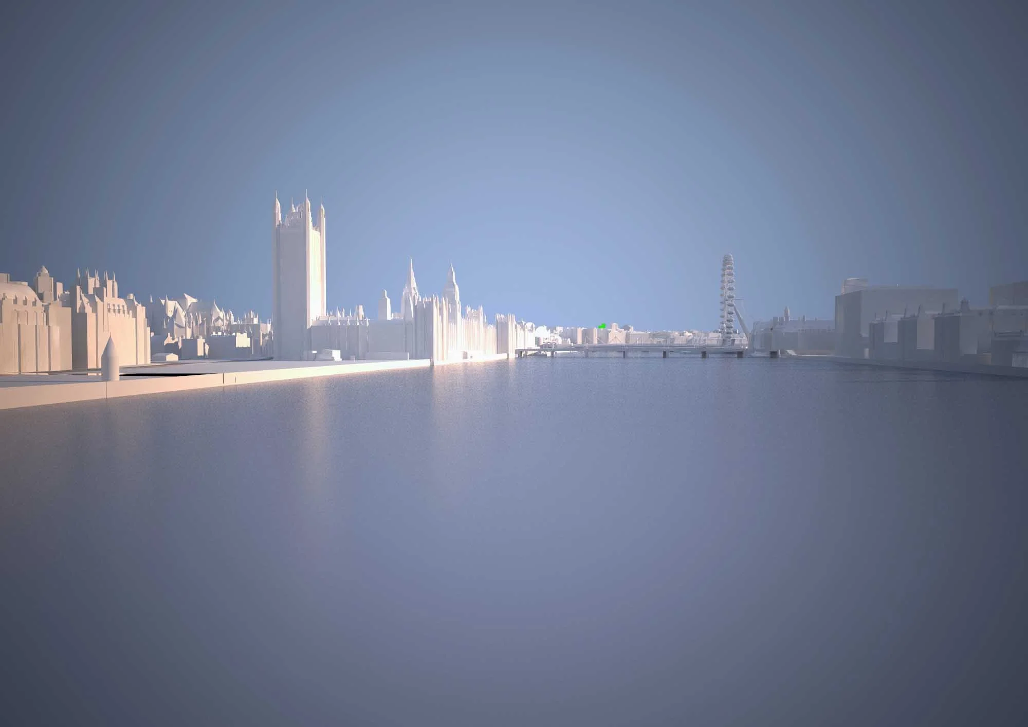
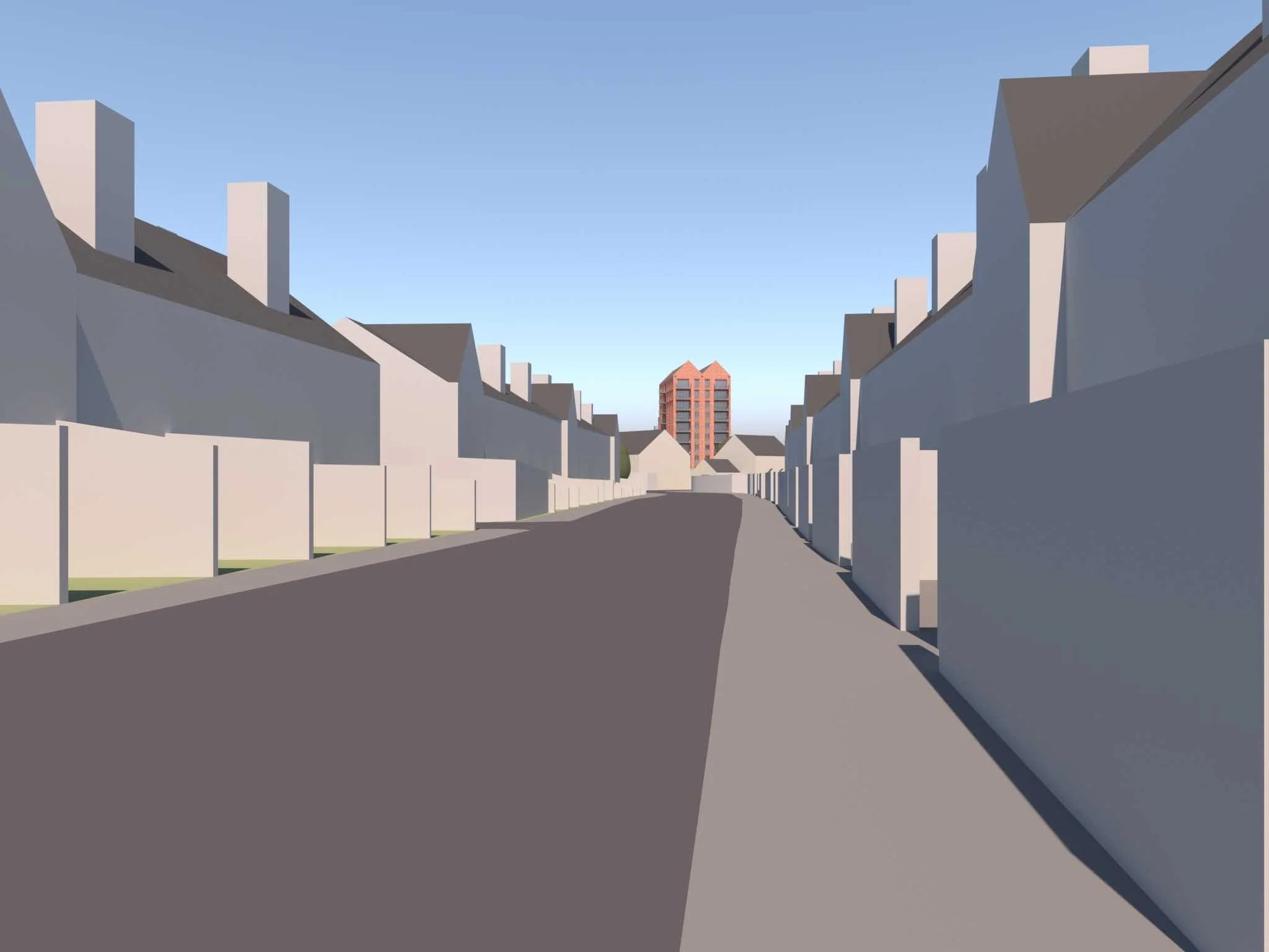
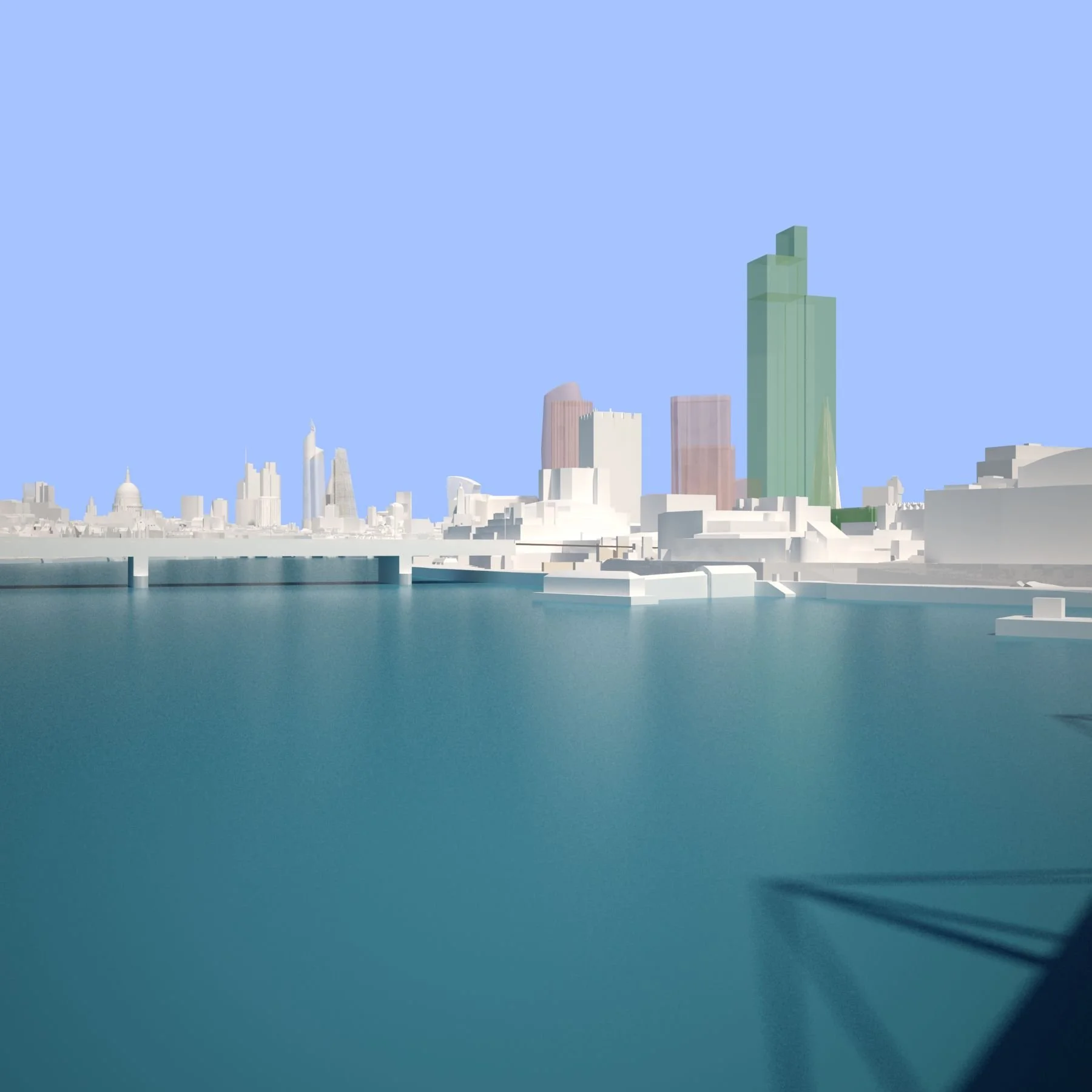
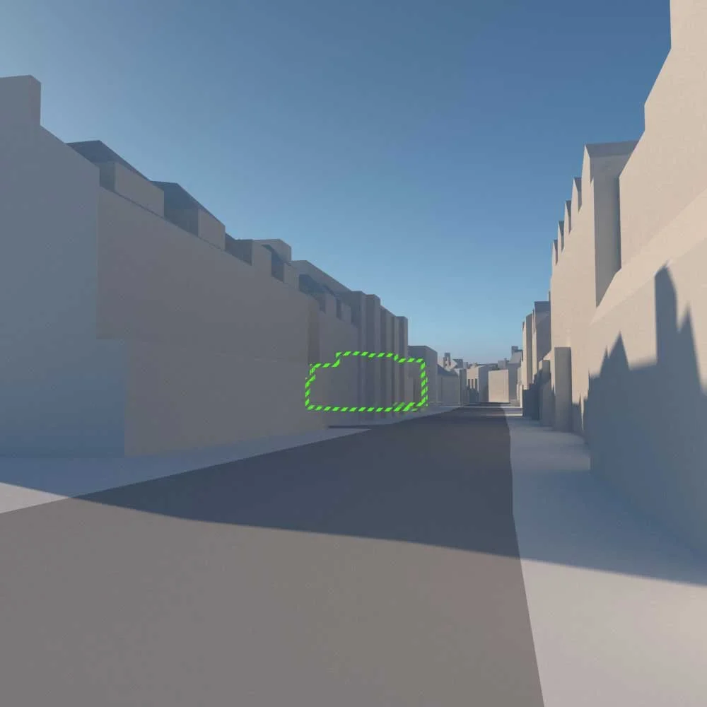
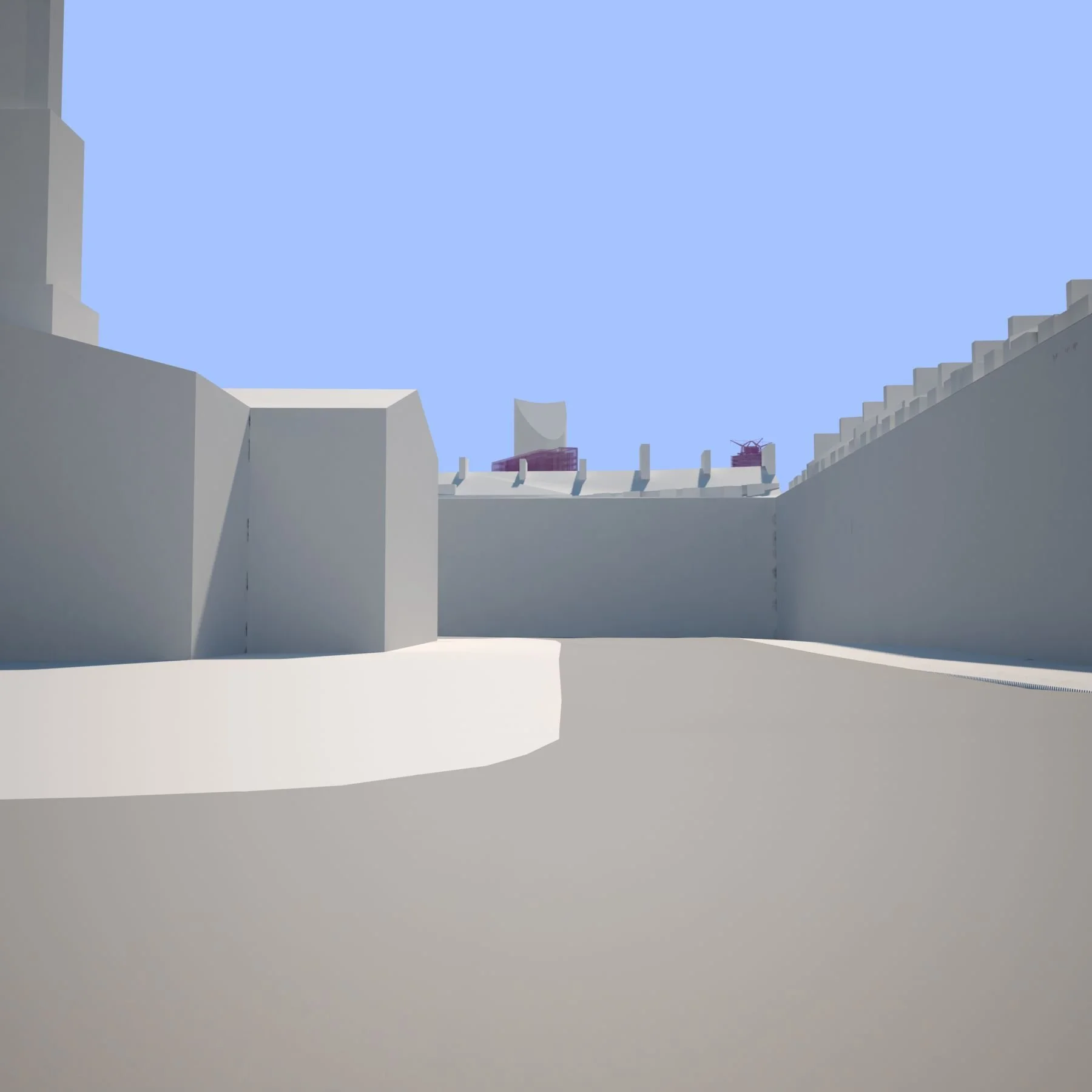
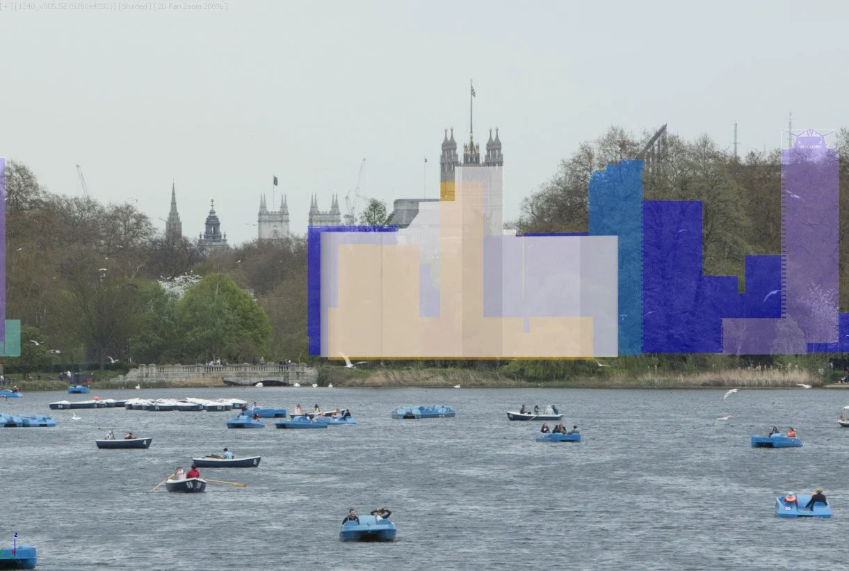
The model is used to test proposals, define development parameters and identify key planning views. Visibility analysis tests proposals within the 3D model to identify where they will be visible across the wider urban area.
We provide :
Detailed 3D modelling with planning analysis to provide clear, measurable and visual evidence for decision-making.
Early-stage site evaluation to assess planning constraints, height thresholds and development capacity
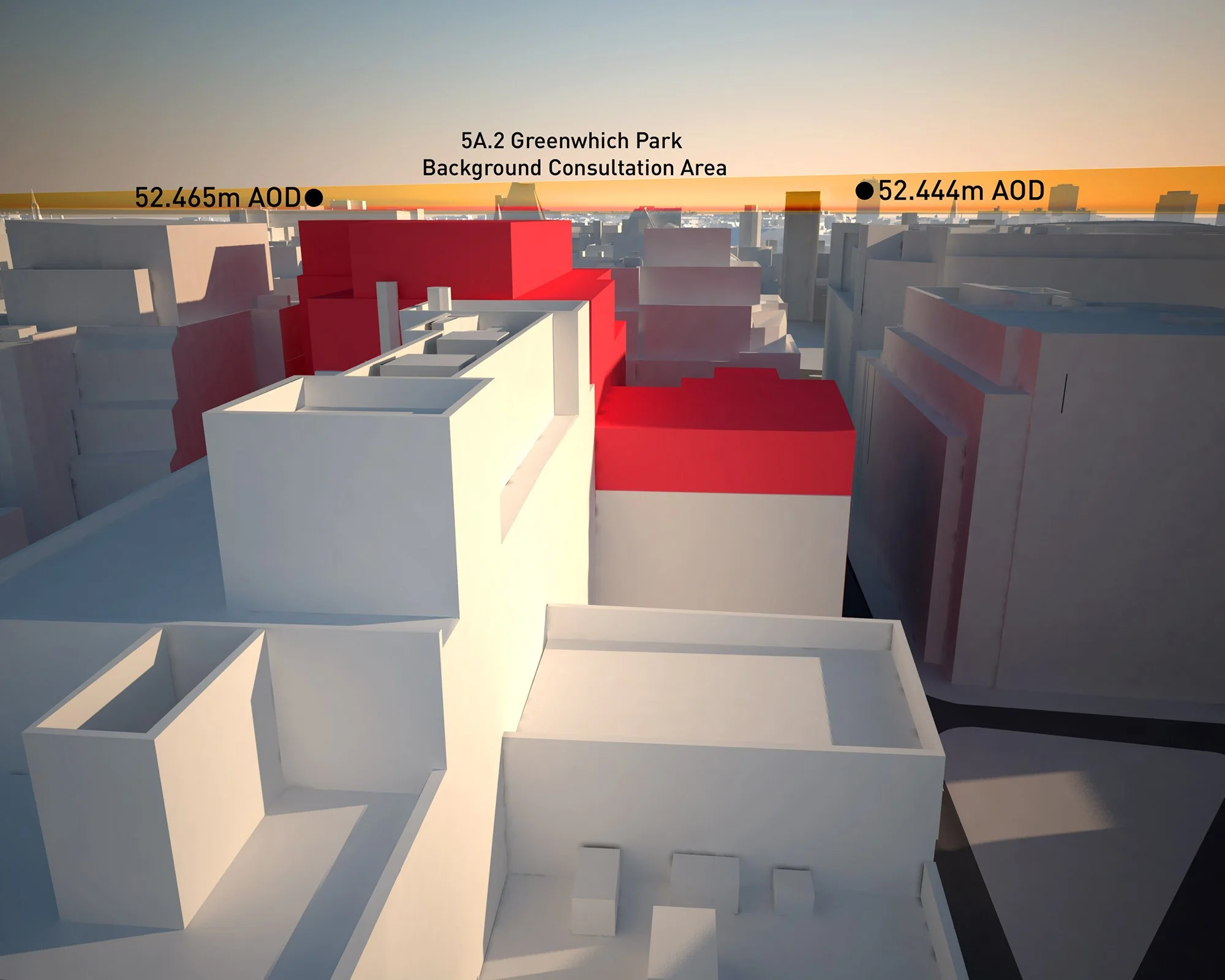
Visibility analysis (ZTV) to identify where proposals will be seen across the wider city
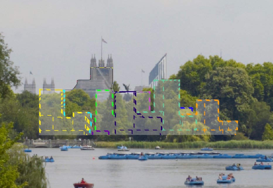
View identification and testing to define candidate views prior to planning submission
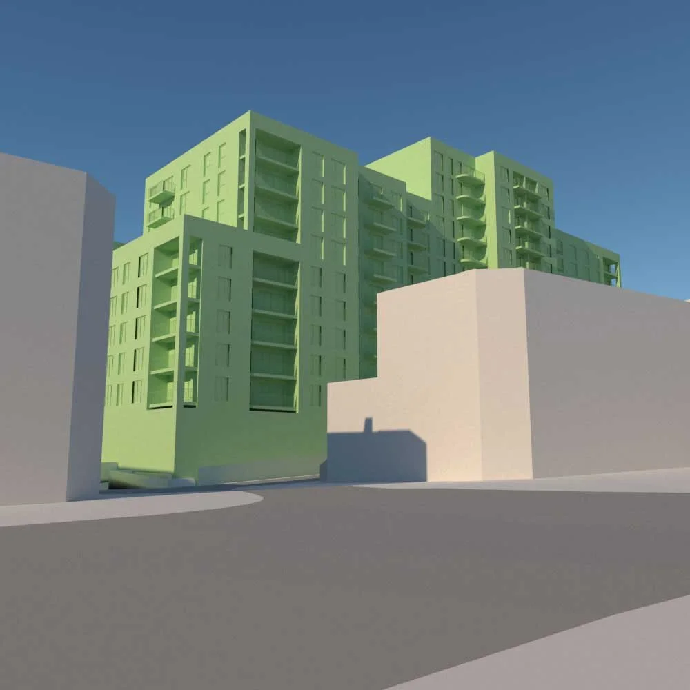
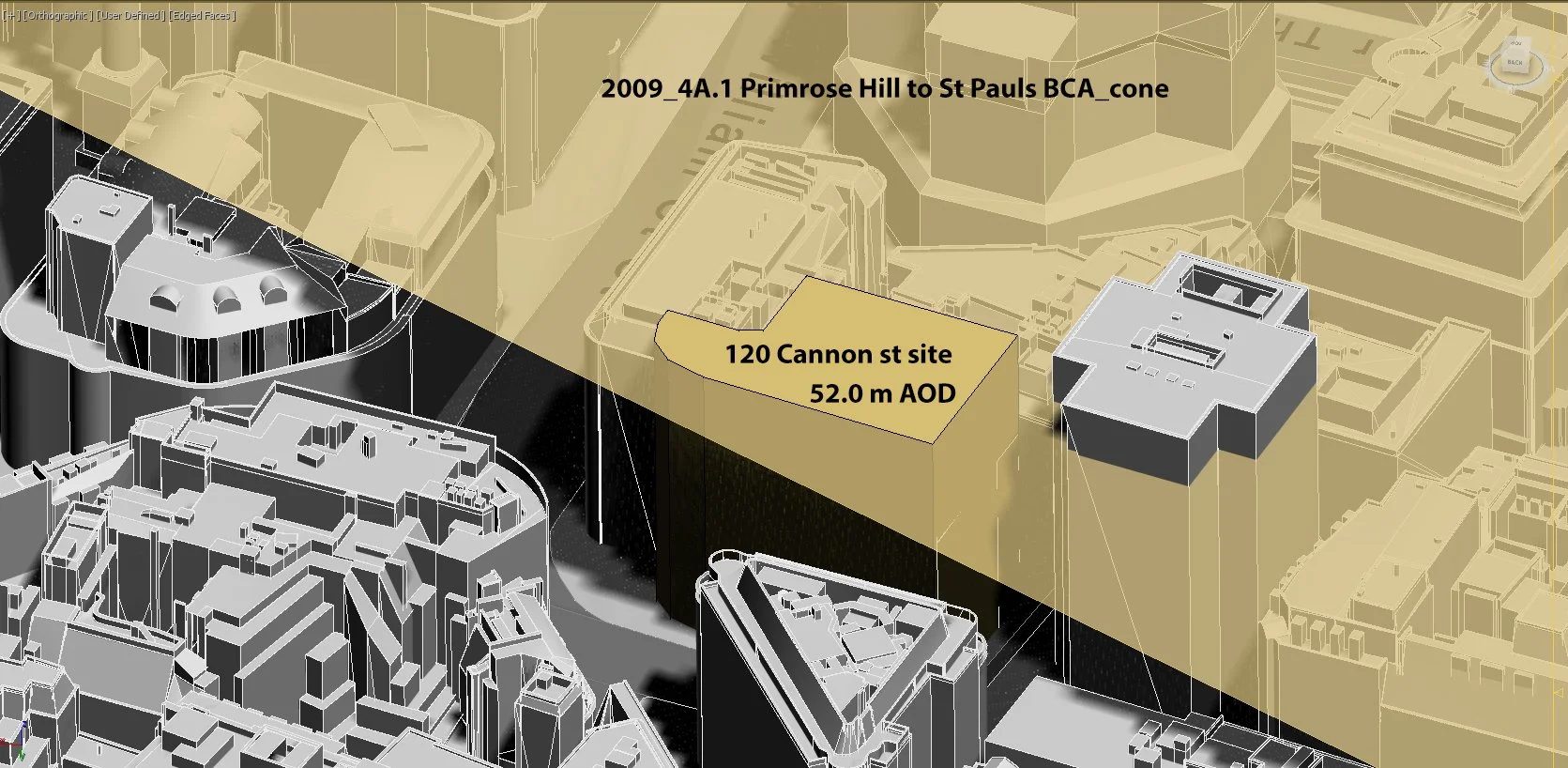
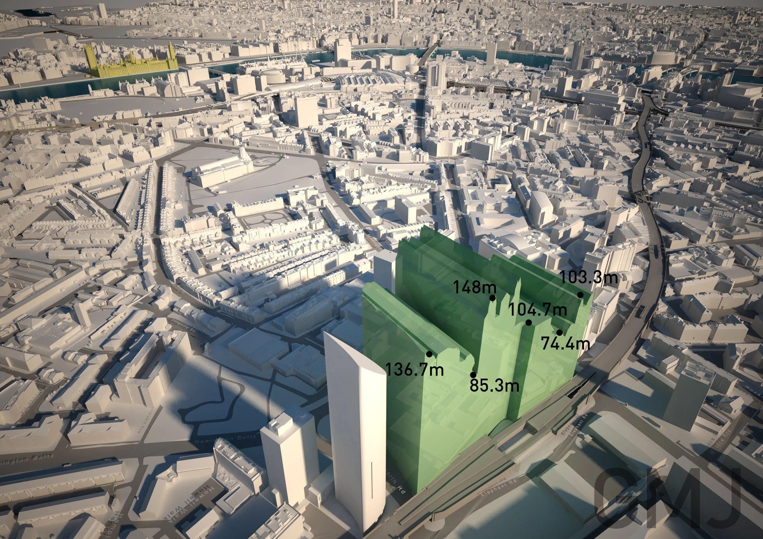
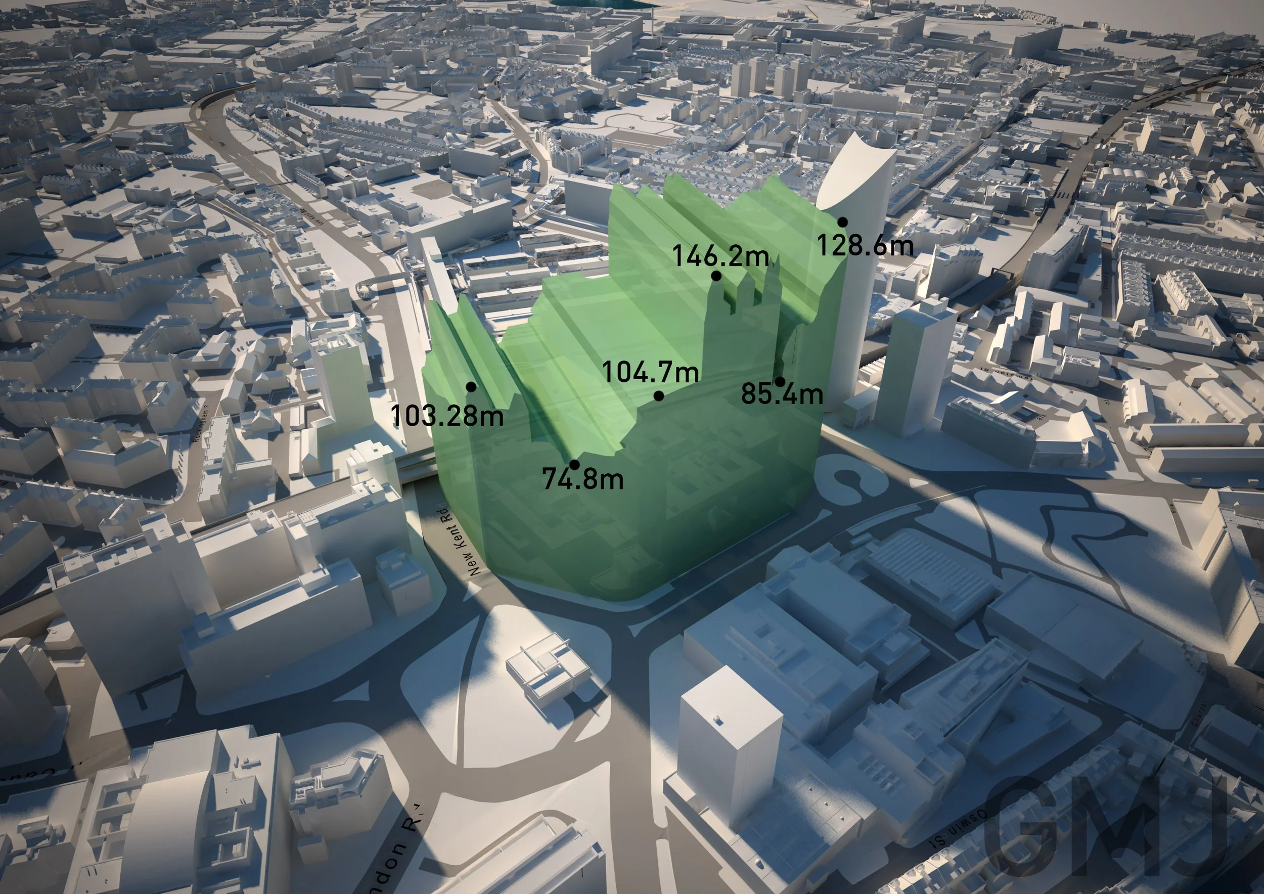
Maximum build envelope modelling to define the limits of development
Planning threshold analysis to test impacts on protected views and heritage assets
These model-based studies are supported by photo-based visualisations to clearly communicate visual impact.
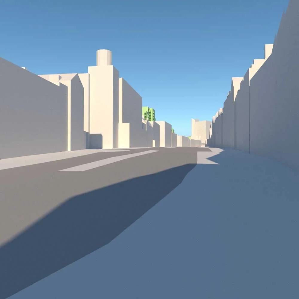
Beyond London, GMJ acquires or rapidly creates 3D models of urban areas to provide environments within which new proposals can be tested and analysed.
Visual examples of this work are shown below.